Possibility of “Remote Sensing”
Remote sensing is “remote exploration”. It is a technology for exploring various phenomena such as land, ocean, and atmosphere from a place far from the ground such as artificial satellites and aircraft.
Polar Star Space uses microsatellite to enable more accurate observations at 1/100 the cost of large satellites. In addition, Polar Star Space will equip drones and microsatellite with LCD tunable filter (LCTF) cameras to enable observations that can be selected from hundreds of bands, the largest number in the world. We will accelerate the actual use of remote sensing in agriculture, fisheries, forestry, and resources, which has been slow to progress.
[Three Core Technologies]
We will build a spectrum library using –
● “LCTF-equipped microsatellite” from space
● “LCTF-equipped drone” from the sky
● “smartphone-integrated spectroscope” on the ground
The possibilities of remote sensing with various solutions will be expanded by library analysis.
- World’s best on-demand high-frequency, high-precision observation
- Building a complete spectrum library
- Solution by library analysis

3 Core Technologies
Smartphone-integrated spectroscope (Patent: 6342594 PCT/JP 2017/029791)
Despite its small size, it has become possible to provide a low-priced, high-performance spectroscope by integrating it with a smartphone.
Features
● Anyone can easily operate it with the smartphone app
● Measurement results comparable to large spectroscopes
● Easy spectrum measurement (spectrum can be measured while checking the measurement target on the screen)
● Attachment equipment can be added (can be replaced with various color measuring equipment such as soil analyzers and freshness analyzers)
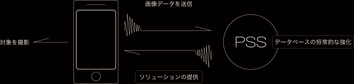
The angle and direction of incident and reflected light are automatically calculated and recorded, and a photograph of the object is added and sent to the network server.
A database is built by automatically accumulating spectrum information taken by users. Providing necessary information to users.
Product details here
Drone+ LCTF Camera (Patent: 6321895 PCT/JP 2017/011411)
By improving the LTCF camera, which was previously mounted on a small satellite,and mounting it on a drone, more accurate observations will be possible.
★From an altitude of 150 m, a field of view of 150 m square, and a resolution of 20 cm.
The optical spectrum changes greatly depending on the imaging angle and orientation.
Drones are also useful for creating libraries to correct it.
It is possible to build a library 100 times more efficiently than the conventional method.
Examples
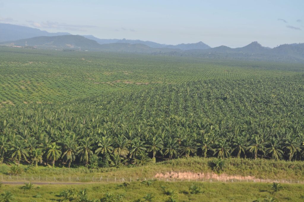
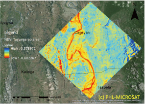
● After observing a wide area with a microsatellite, it will be pinpointed with a drone.
● Regularly observe large-scale plantations to accurately understand the damage caused by pests and the harvest time.
- LCTF camera with the largest number of hundred bands in the world
- Shooting 150m square from an altitude of 150m
- High resolution ☆ 20cm
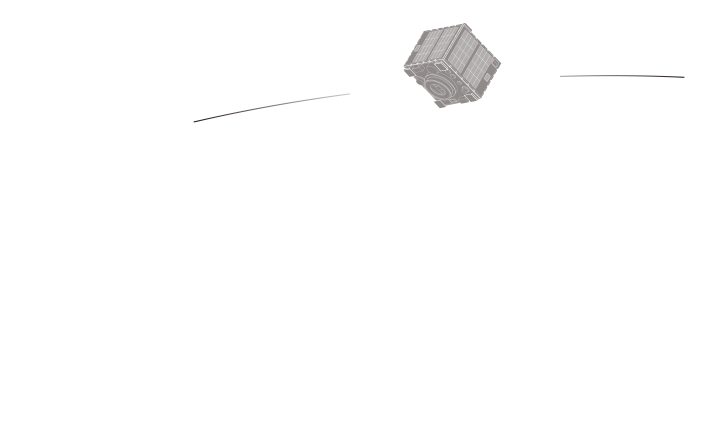
Microsatellite+LCTF Camera
The price and weight of a camera using a tunable liquid crystal filter (LTCF Camera) for satellite mounting is 1/100 of that of conventional hyperspectral observation equipment.
The ground resolution of the spectrum camera of a microsatellite is 5m.
High-frequency observation is possible with free short-time orientation.
The field of view of the camera mounted on the microsatellite is not wide, but the field of view is about 10 times that of the conventional camera used in the LANDSAT satellite and about 100 times that of the state-of-the-art hyperspectral sensor.
It is proportional to the observation frequency.
Toward the remote sensing business that will bear the future of humankind, we aim to establish a data sharing protocol by building the Asia Microsatellite Consortium.
- LCTF camera with the largest number of hundred bands in the world
- High-frequency observation with free short-time orientation
- Asia Microsatellite Consortium